RTK
NoAutel EVO II Dual 640T V3
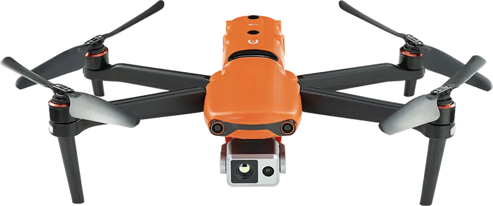
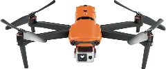
Autel EVO II Dual 640T V3
Price (US)$5,999
Weight1,209 g
Max Flight Time38 min
Max Speed20 m/s
Quick Highlights
Sensor Size
1/1.28"Megapixels
50 MPObstacle Avoidance
Active (Avoidance)EU Drone Class
C2Internal Storage
8 GBMax Flight Distance
22 kmMax Flight Time
38 minFlight Time vs Price
Megapixels vs Price
User Reviews
No reviews yet — be the first!
Write the first review →Known Issues
No known issues reported for this drone yet.
Report Issue →Full Specifications
Identity7
Manufacturer
Autel
Rating
Known Issues
Release Date
Oct 19, 2022
Availability
Available
EU Drone Class
C2
Platform Type
Multirotor
Pricing2
Price (EU) (€)
€5,519
Price (US) ($)
$5,999
Links2
Physical5
Weight (g)
1,209 g
Max Takeoff Weight (g)
1,999 g
Folded Dimensions (mm)
230 × 130 × 108 mm
IP Rating
—
Operating Temperature (°C)
-10°C to 40°C
Flight8
Max Flight Time (min)
38 min
Max Speed (m/s)
20 m/s
Max Speed (EU) (m/s)
—
Max Ascent Speed (m/s)
8 m/s
Max Descent Speed (m/s)
4 m/s
Max Flight Distance (km)
22 km
Max Altitude (m)
7,000 m
Wind Resistance (m/s)
10.7 m/s
Payload1
Camera2
Camera 1
Visible Light Camera
Sensor Size
1/1.28"
Megapixels (MP)
50 MP
Focal Length
23mm
Aperture
f/1.9
Zoom
16x Digital
Mechanical Shutter
—
ISO Range
100-64000 (Video)100-6400 (Photo)
+1Shutter Speed
1/8000-8s (Photo)1/8000-1/frame rate s (Video)
+1Stabilization Type
Mechanical Gimbal
Max Photo Resolution
8192x6144
Image Formats
JPEGDNG (RAW)
AEB
3 Frames5 Frames
AEB EV Bias
0.7 EV
Panorama Modes
—
Panorama Formats
—
Video Resolutions
4k/60fps1528p/60fpsFHD/60fps
+1Video Codec
H.264 (AVC)H.265 (HEVC)
+1Video Formats
MP4MOV
Color Profiles
—
Camera 2
Thermal Camera
Gimbal1
Gimbal1
Gimbal 1
3-Axis Gimbal
Stabilization Axes
3-Axis
Tilt Range (°)
-90° to 30°
Pan Range (°)
-90° to 90°
Roll Range (°)
0° to 0°
Navigation9
GNSS
GPSGLONASSGalileoBeiDou
+2Hover Accuracy
Vert: ±0.1m (Vision), ±0.5m (GNSS); Horiz: ±0.3m (Vision), ±1.5m (GNSS)
RTK
No
RTK Horizontal Accuracy
—
RTK Vertical Accuracy
—
Obstacle Sensors
ForwardBackwardLateralUpwardDownward
+3Obstacle Avoidance
Active (Avoidance)
Sensing Technology
Vision (Binocular)Ultrasonic
+1Sensing Technology (Add-on)
—
Transmission5
Transmission Protocol
SkyLink 2.0
Max Range (CE) (km)
8 km
Max Range (FCC) (km)
15 km
Live View Quality
1080p/30fps
Cellular
—
App4
Flight App
Autel Explorer
Supported OS
iOSAndroid
Resume from Waypoint
—
Mission Types
WaypointAreaOblique
+1Features12
Internal Storage (GB)
8 GB
Max MicroSD (GB)
256 GB
ActiveTrack
✓ Yes
Hyperlapse
✓ Yes
Night Scene
✓ Yes
NIR Light
—
Laser Rangefinder
—
Laser Rangefinder Range (m)
—
ADS-B Receiver
✓ Yes
Data Encryption
✓ Yes
Expansion Port
✓ Yes
SDK Support
✓ Yes
Mapping3
Waypoints
✓ Yes
Terrain Follow
✗ No
Raw GNSS Logging
—
Cargo3
Delivery Mode
—
Max Range (Loaded) (km)
—
Max Flight Time (Loaded) (min)
—
Accessories4
Battery1
Propeller1
Remote Controller1
Charger1