RTK
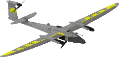
NoQuantum Systems Trinity Pro
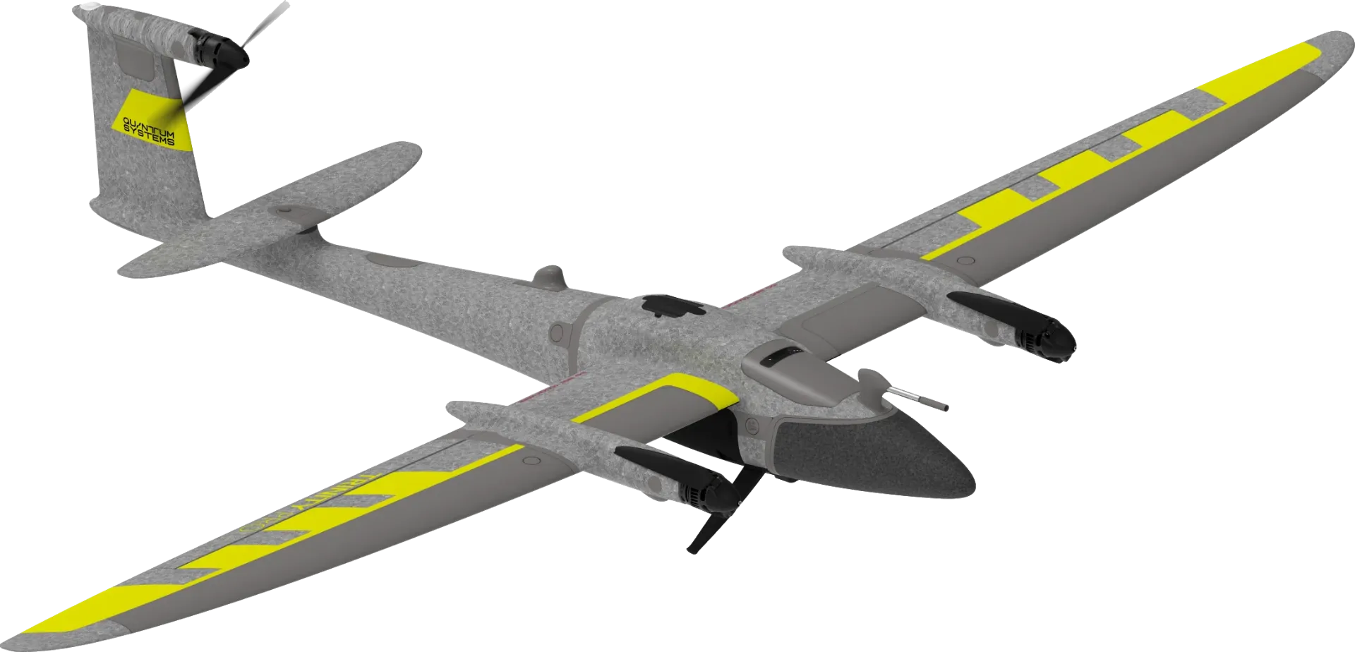
Quantum Systems Trinity Pro
Price (US)$23,789.94
Weight4,750 g
Max Flight Time90 min
Max Speed20 m/s
Quick Highlights
Sensor Size
Full FrameMegapixels
61 MPMechanical Shutter
✓ YesIP Rating
IP55Obstacle Avoidance
Active (Avoidance)Frame Coverage at 120m
2.15 ha, 0.34 haEU Drone Class
NoneFlight Time vs Price
Megapixels vs Price
User Reviews
No reviews yet — be the first!
Write the first review →Known Issues
No known issues reported for this drone yet.
Report Issue →Full Specifications
Identity7
Manufacturer
Quantum Systems
Rating
Known Issues
Release Date
May 2, 2023
Availability
Available
EU Drone Class
None
Platform Type
VTOL
Pricing2
Price (EU) (€)
€20,729
Price (US) ($)
$23,789.94
Links2
Product Page
Physical5
Weight (g)
4,750 g
Max Takeoff Weight (g)
5,750 g
Folded Dimensions (mm)
1,002 × 830 × 270 mm
IP Rating
IP55
Operating Temperature (°C)
-12°C to 50°C
Flight8
Max Flight Time (min)
90 min
Max Speed (m/s)
20 m/s
Max Speed (EU) (m/s)
20 m/s
Max Ascent Speed (m/s)
—
Max Descent Speed (m/s)
—
Max Flight Distance (km)
—
Max Altitude (m)
5,500 m
Wind Resistance (m/s)
18 m/s
Payload1
Camera3
Camera 1
Sony ILX-LR1
Sensor Size
Full Frame
Pixel Binning
—
Megapixels (MP)
61 MP
Focal Length
24mm
Aperture
f/2.8
Zoom
—
Mechanical Shutter
✓ Yes
ISO Range
—
Shutter Speed
—
Stabilization Type
—
Max Photo Resolution
9504x6336
Image Formats
RAW (Proprietary)JPEGHEIF
+1AEB
—
AEB EV Bias
—
Panorama Modes
—
Panorama Formats
—
Video Resolutions
—
Video Codec
—
Video Formats
—
Color Profiles
—
Camera 2
Phase One P5
Camera 3
Oblique D2M
Gimbal1
Gimbal1
Gimbal 1
Stabilization Axes
—
Tilt Range (°)
—
Pan Range (°)
—
Roll Range (°)
—
Navigation9
GNSS
GalileoGPSGLONASSBeiDou
+2Hover Accuracy
—
RTK
No
RTK Horizontal Accuracy
—
RTK Vertical Accuracy
—
Obstacle Sensors
Downward
Obstacle Avoidance
Active (Avoidance)
Sensing Technology
LiDAR
Sensing Technology (Add-on)
—
Transmission5
Transmission Protocol
—
Max Range (CE) (km)
7.5 km
Max Range (FCC) (km)
7.5 km
Live View Quality
—
Cellular
✓ Yes
App4
Flight App
—
Supported OS
—
Resume from Waypoint
✓ Yes
Mission Types
WaypointAreaCorridorObliqueLinearGeometric
+4Features12
Internal Storage (GB)
—
Max MicroSD (GB)
—
ActiveTrack
—
Hyperlapse
—
Night Scene
—
NIR Light
—
Laser Rangefinder
—
Laser Rangefinder Range (m)
—
ADS-B Receiver
✓ Yes
Data Encryption
—
Expansion Port
—
SDK Support
—
Mapping3
Waypoints
✓ Yes
Terrain Follow
✓ Yes
Raw GNSS Logging
—
Cargo3
Delivery Mode
—
Max Range (Loaded) (km)
—
Max Flight Time (Loaded) (min)
—
Accessories4
Battery1
Propeller1
Remote Controller1
Charger1